
Park maps serve a practical purpose by helping guests navigate during their visit. They also make great souvenirs and give a glimpse into the past. The maps throughout the years are a snapshot of what attractions and other features the park offered at any given point in time. Check out the maps below to see how Busch Gardens Tampa has changed since it opened in 1959.
Below are maps of the park from 1959 to the present day, including from the regular operating seasons, Christmas Town, and select other events. For Howl-O-Scream maps, click here.
You can click on most map images to view them in higher resolution.
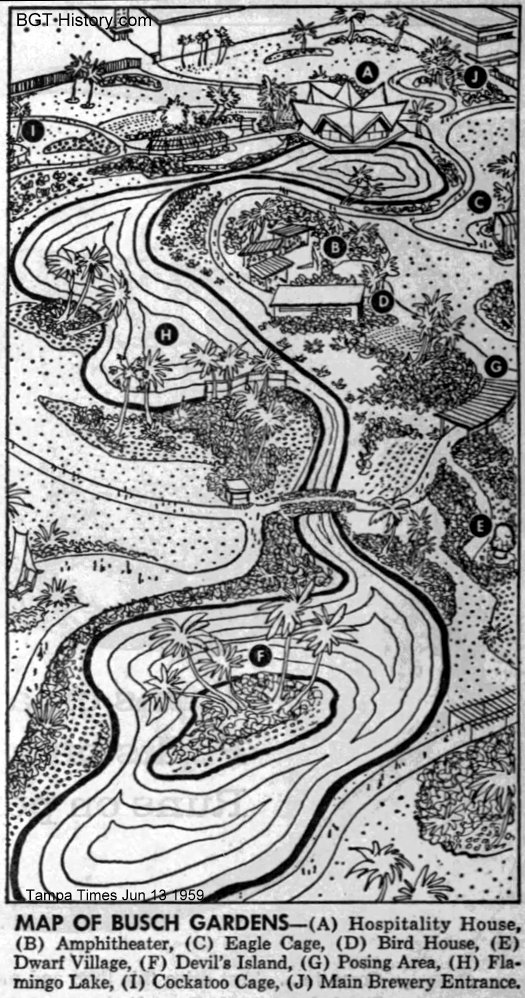
1959
This map was printed in The Tampa Times on June 13, 1959, just days after the park opened to guests for the first time on June 1. It shows the original layout of the gardens and other features that greeted the park’s first guests.
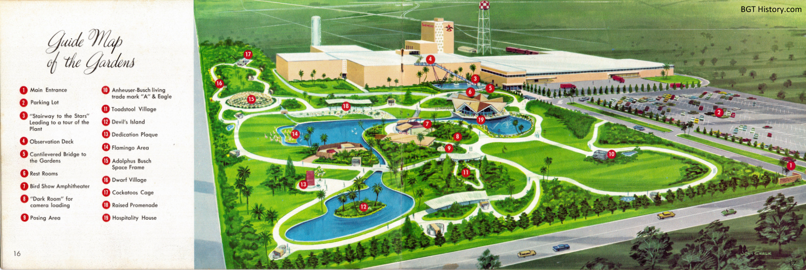
1960s – Early
This undated map is part of a souvenir booklet from the first several years of the park’s existence.
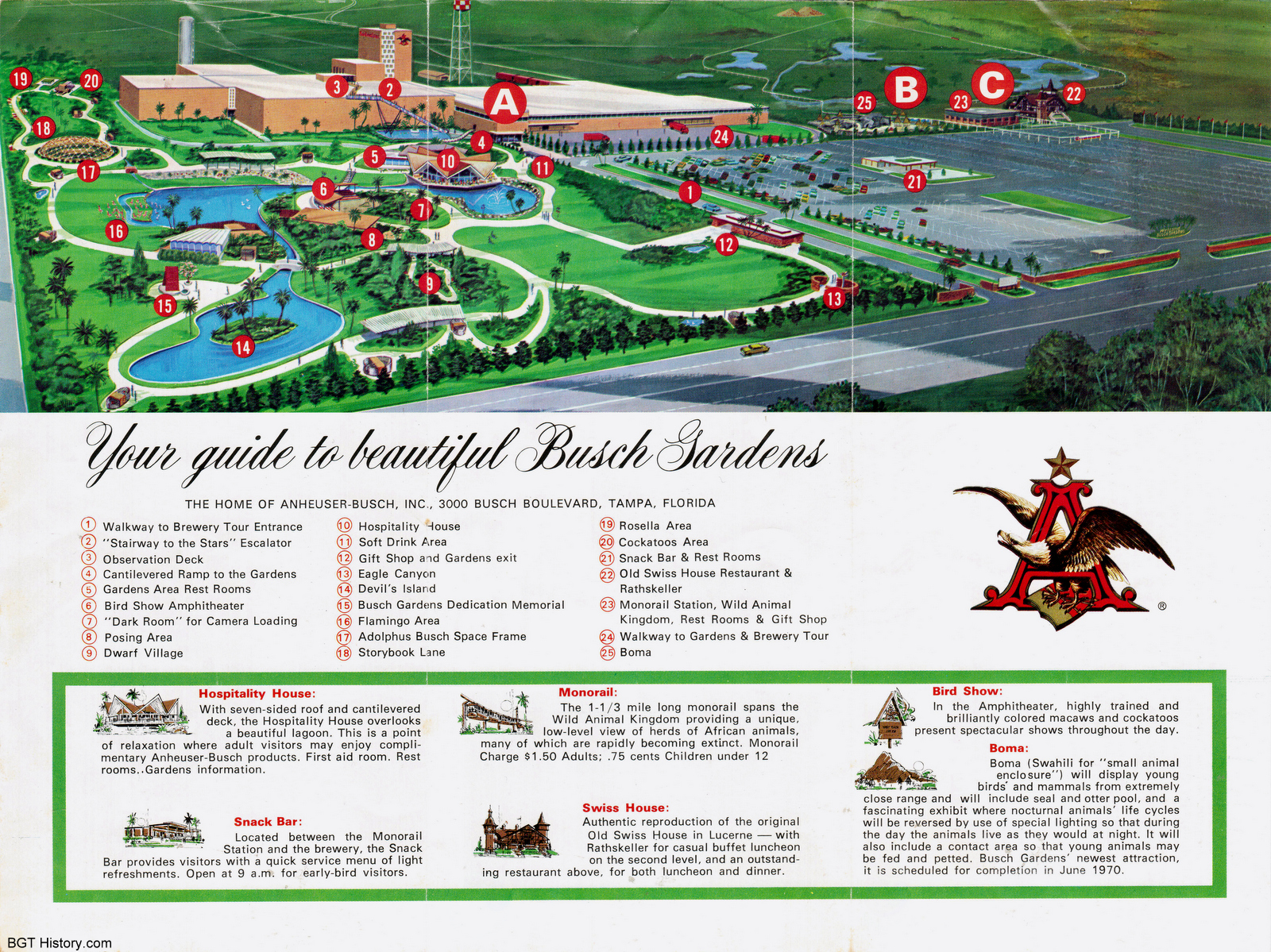
1970
This map highlights the addition of Boma, which according to the brochure was scheduled to open in June 1970. In comparison to the older map above, note the addition of the monorail and Swiss House on the right, and the Snack Bar (#21) out in the parking lot – better known today as Zagora Cafe.
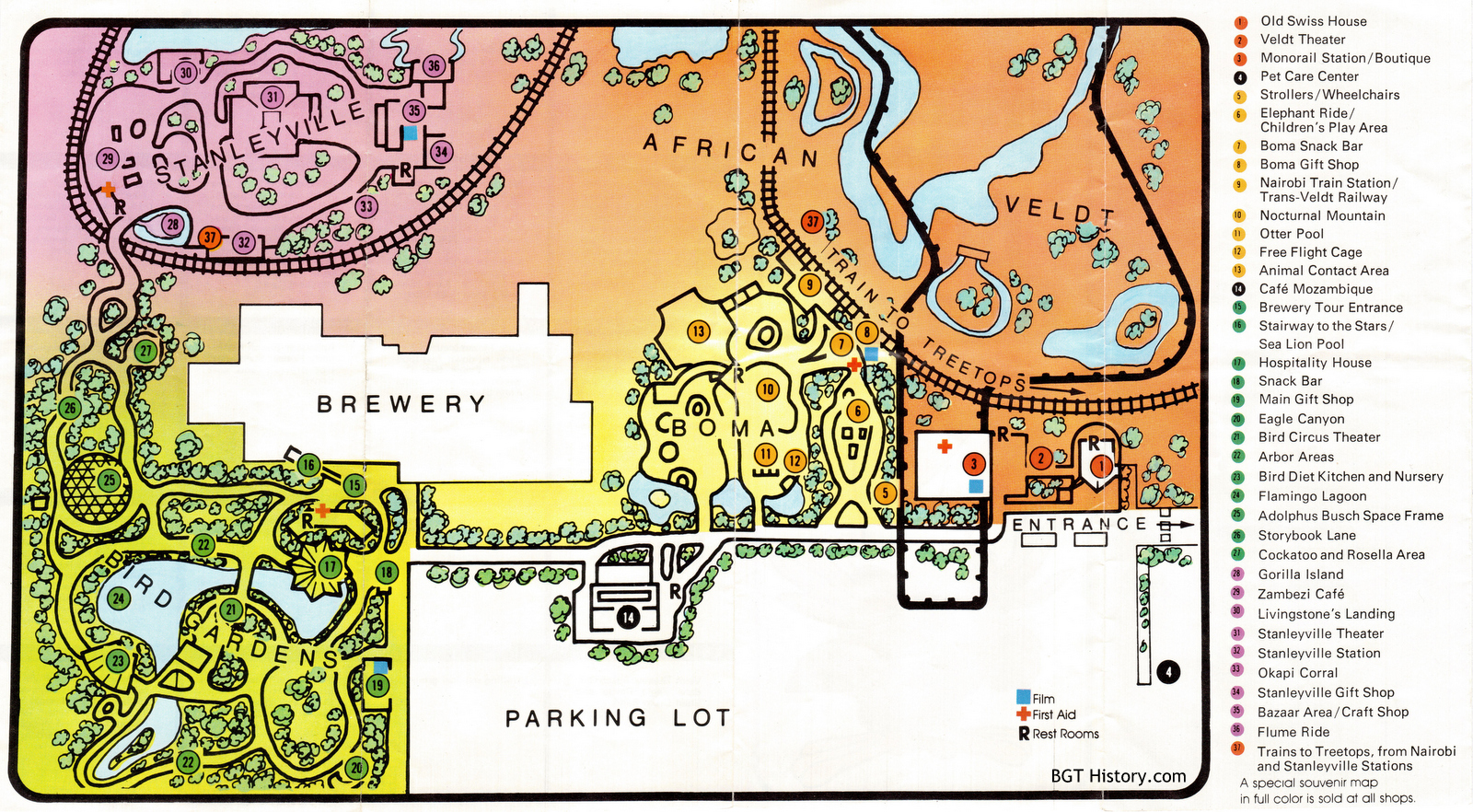
1974 – Spring
The expansion of Busch Gardens continued in the early 1970s with the addition of Stanleyville and the train connecting it to the Boma area.
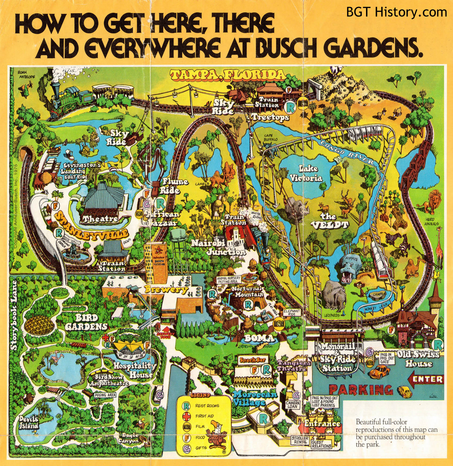
1975
1976 – September
This map includes Python, which opened on July 1, 1976.
1977
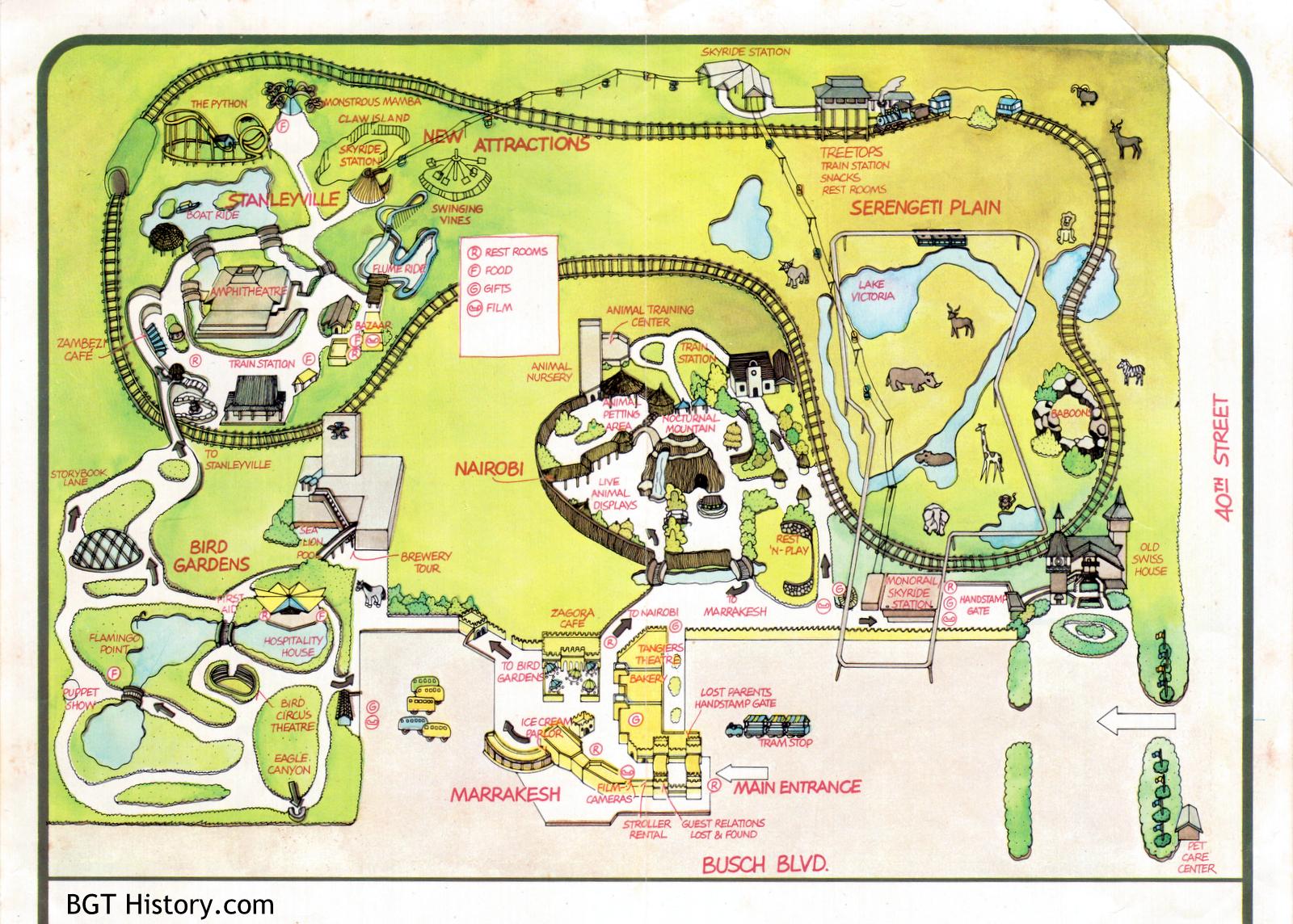
This map has the addition of Swinging Vines and Claw Island in Stanleyville.
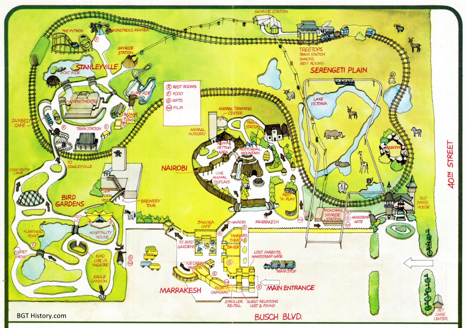
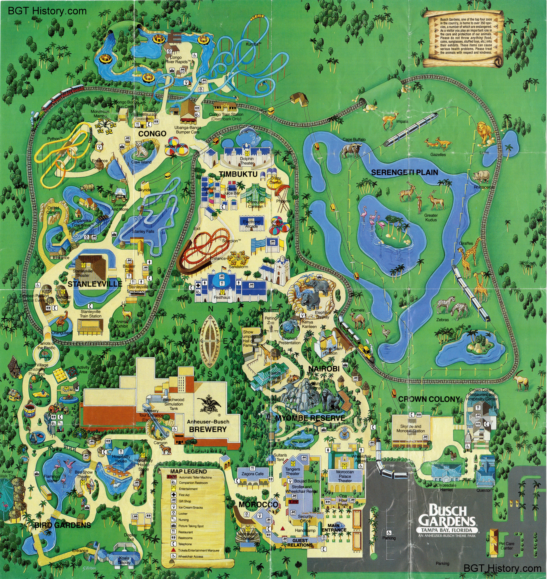
1985
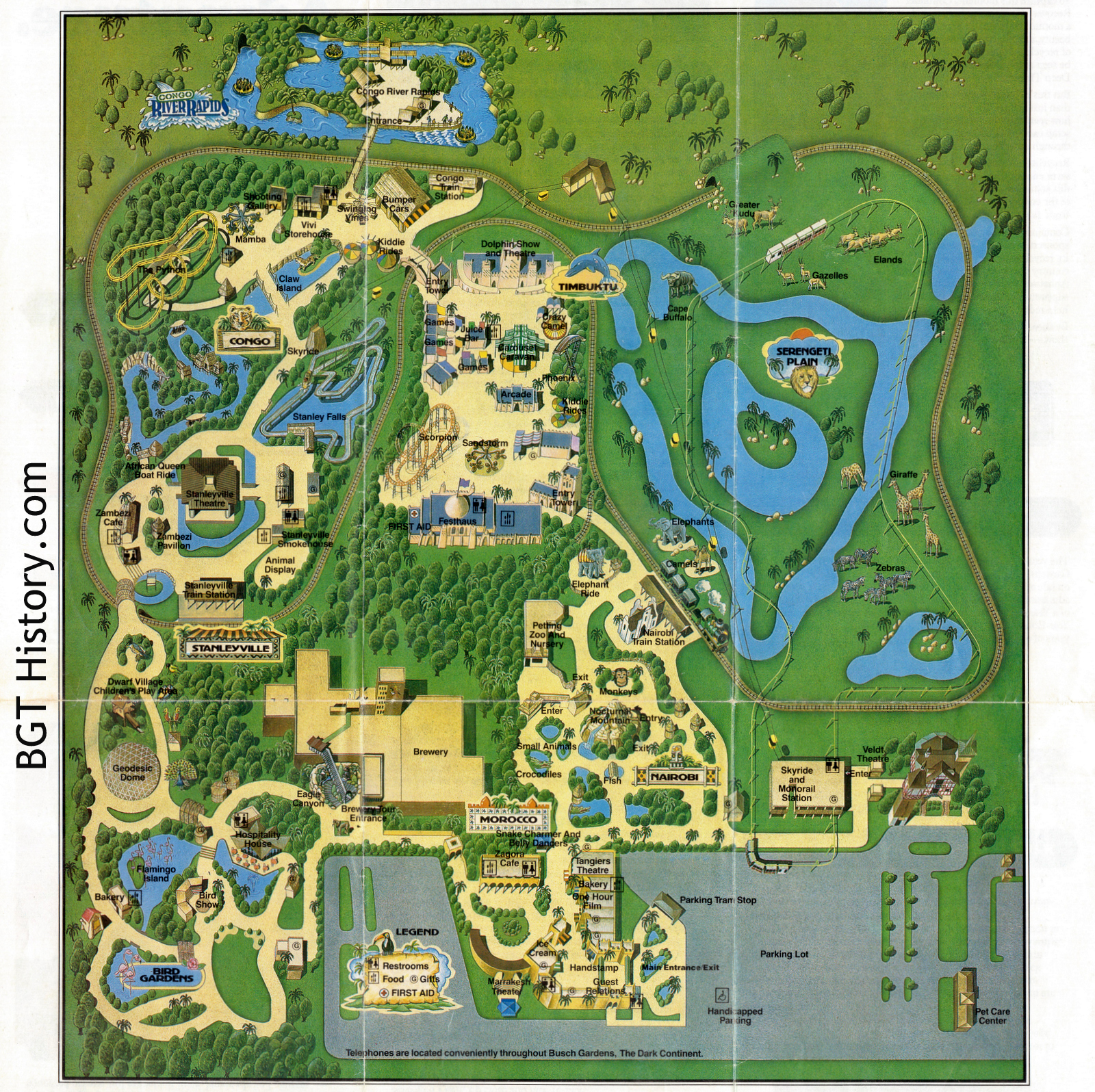
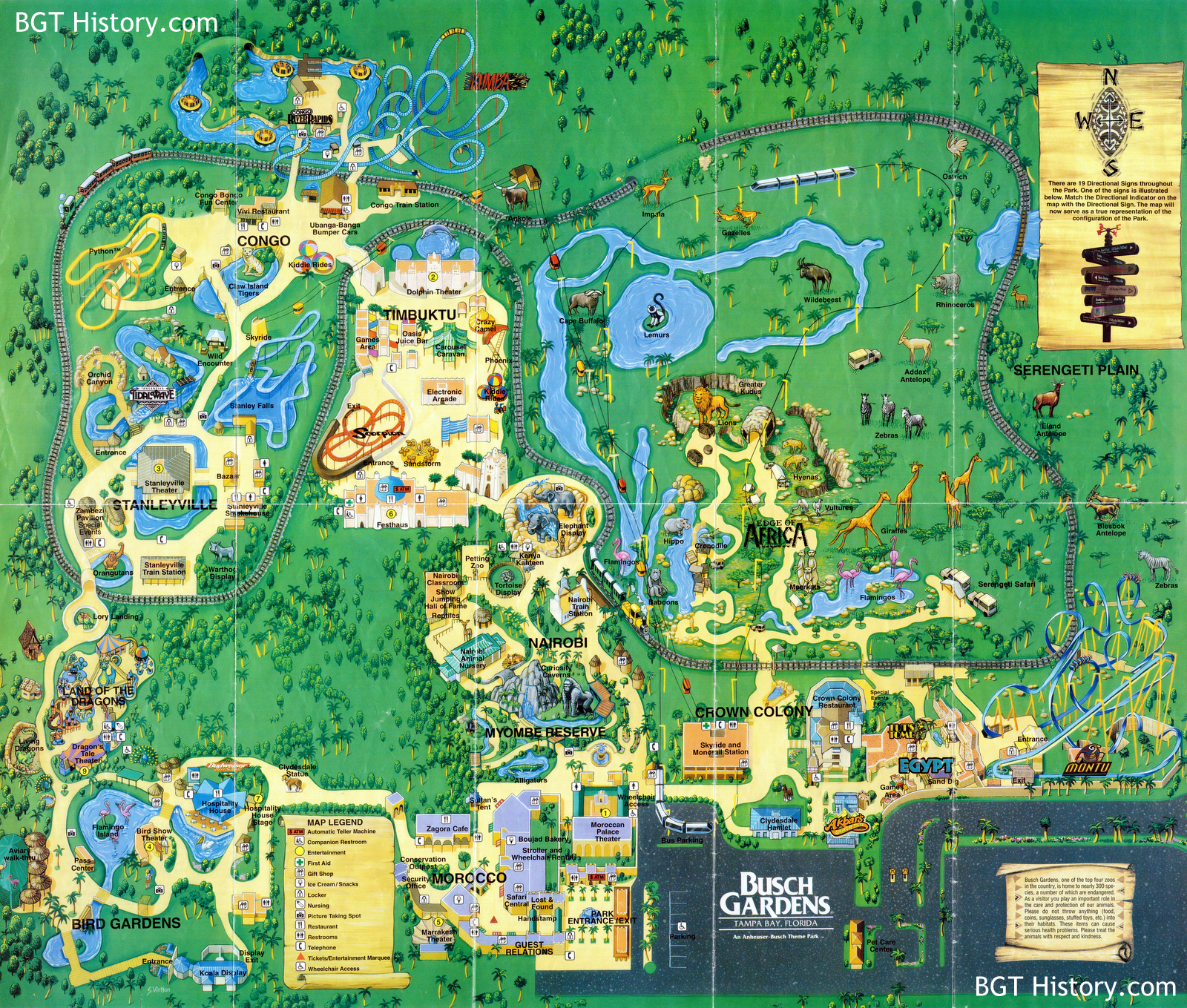
1993
1999
Special thanks to “Stingray” Tom for donating this map.
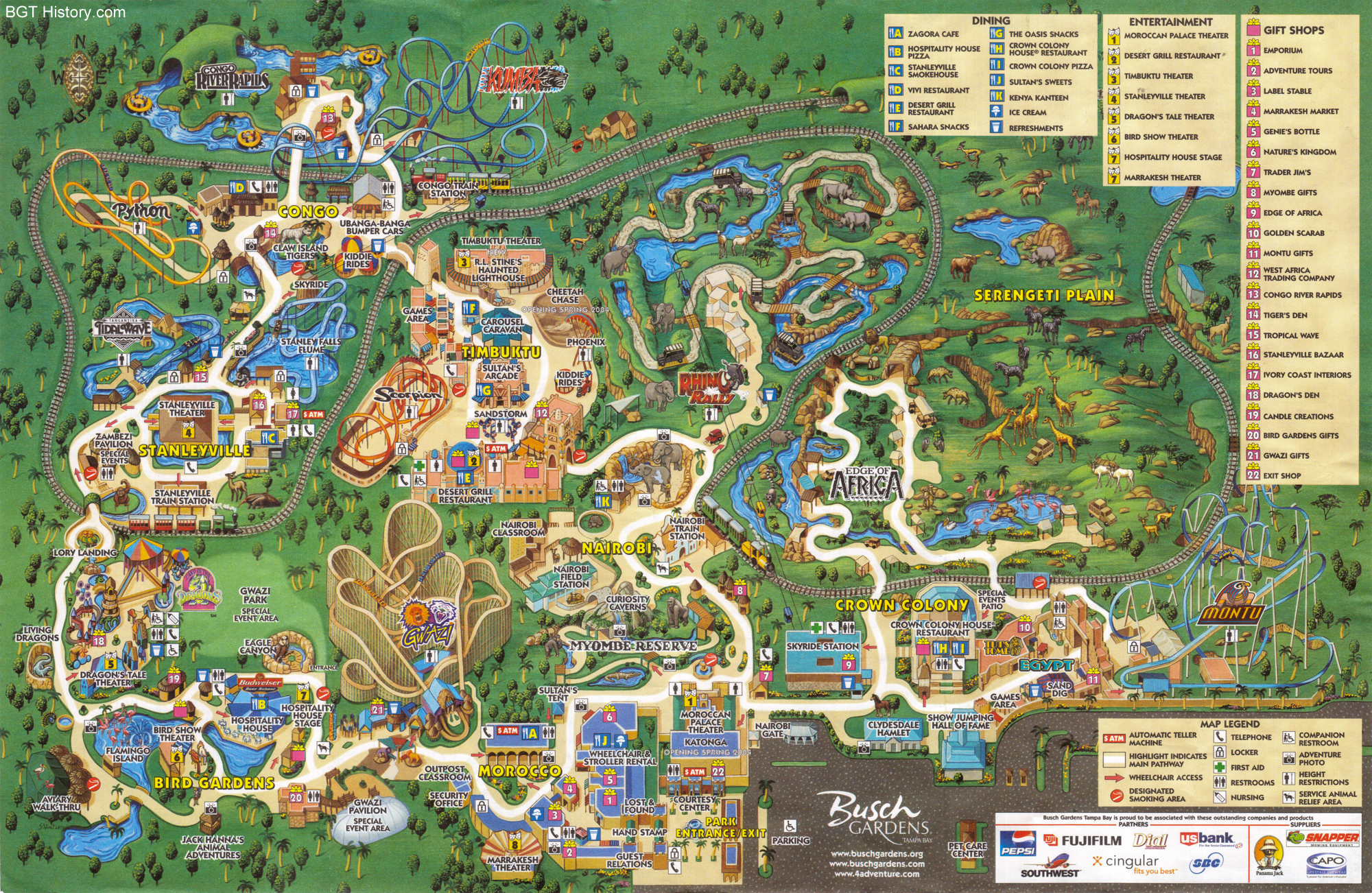
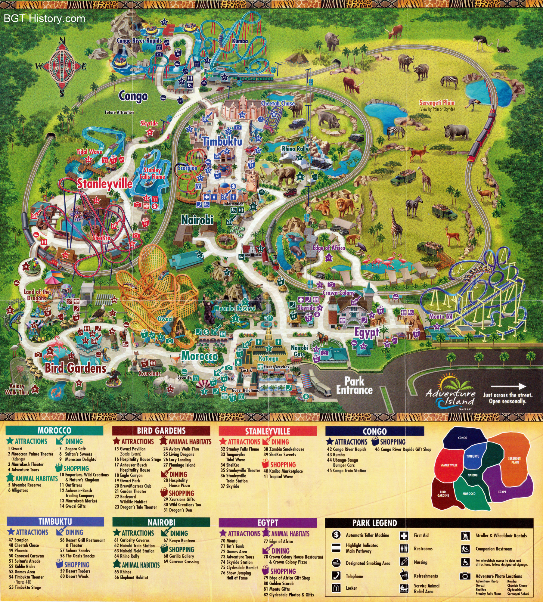
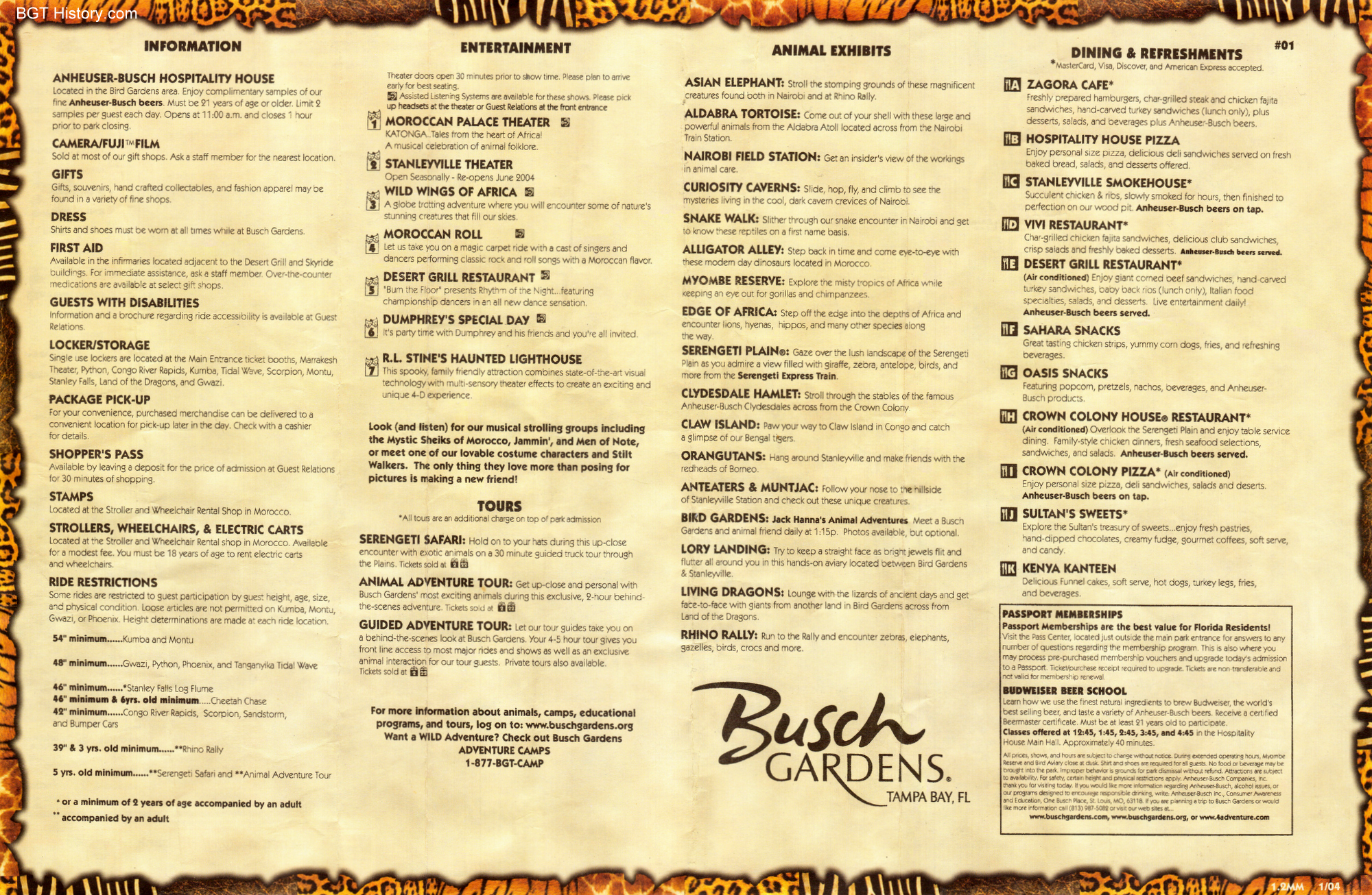
2004 – January
From early 2004, this map notes that Cheetah Chase will open in the spring in Timbuktu. See the back of this map by clicking here.
2005 – May
2007
This map from 2007 shows the new Jungala area under construction, labeled as “Future Attraction.”
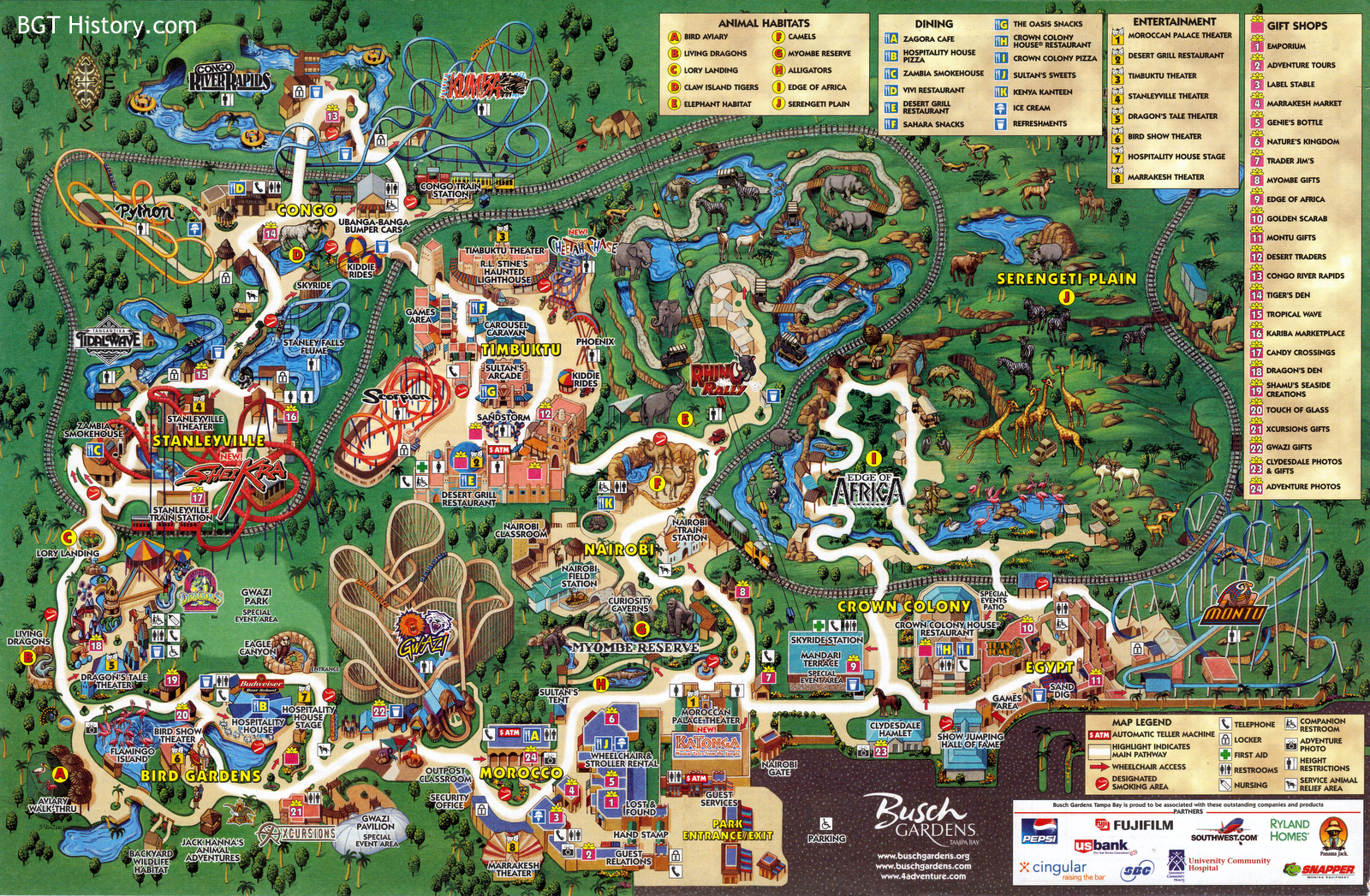
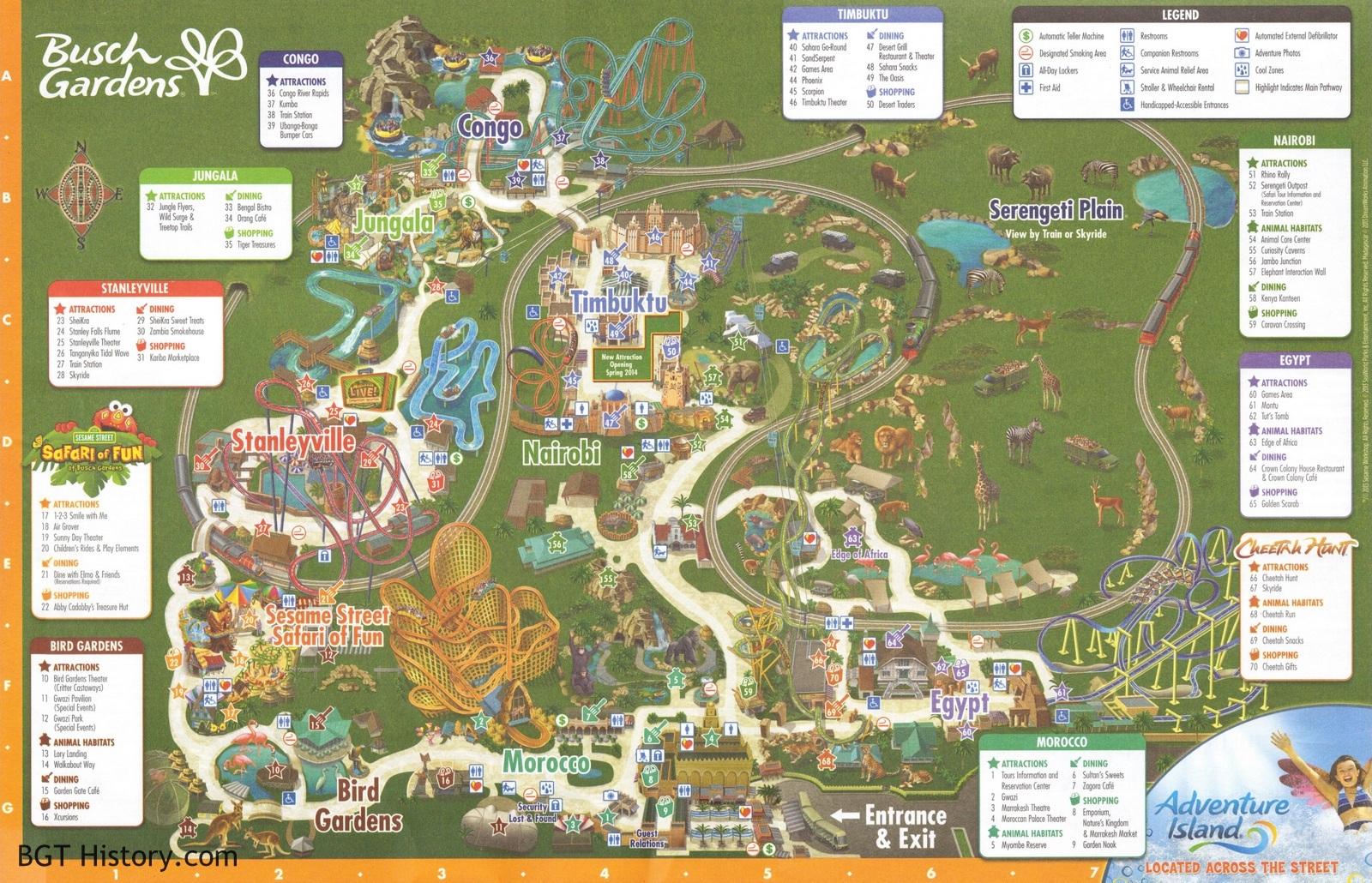
2013 – Fall
2016 – Summer
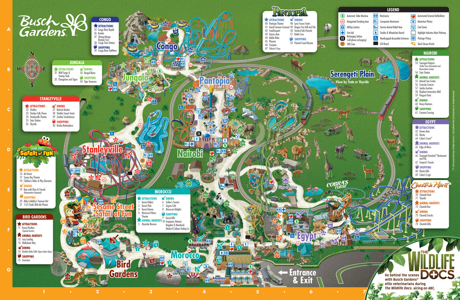
This map has the addition of Cobra’s Curse and the change of Crown Colony to Serengeti Overlook.
2016 – Pokémon GO Lure-a-Thon
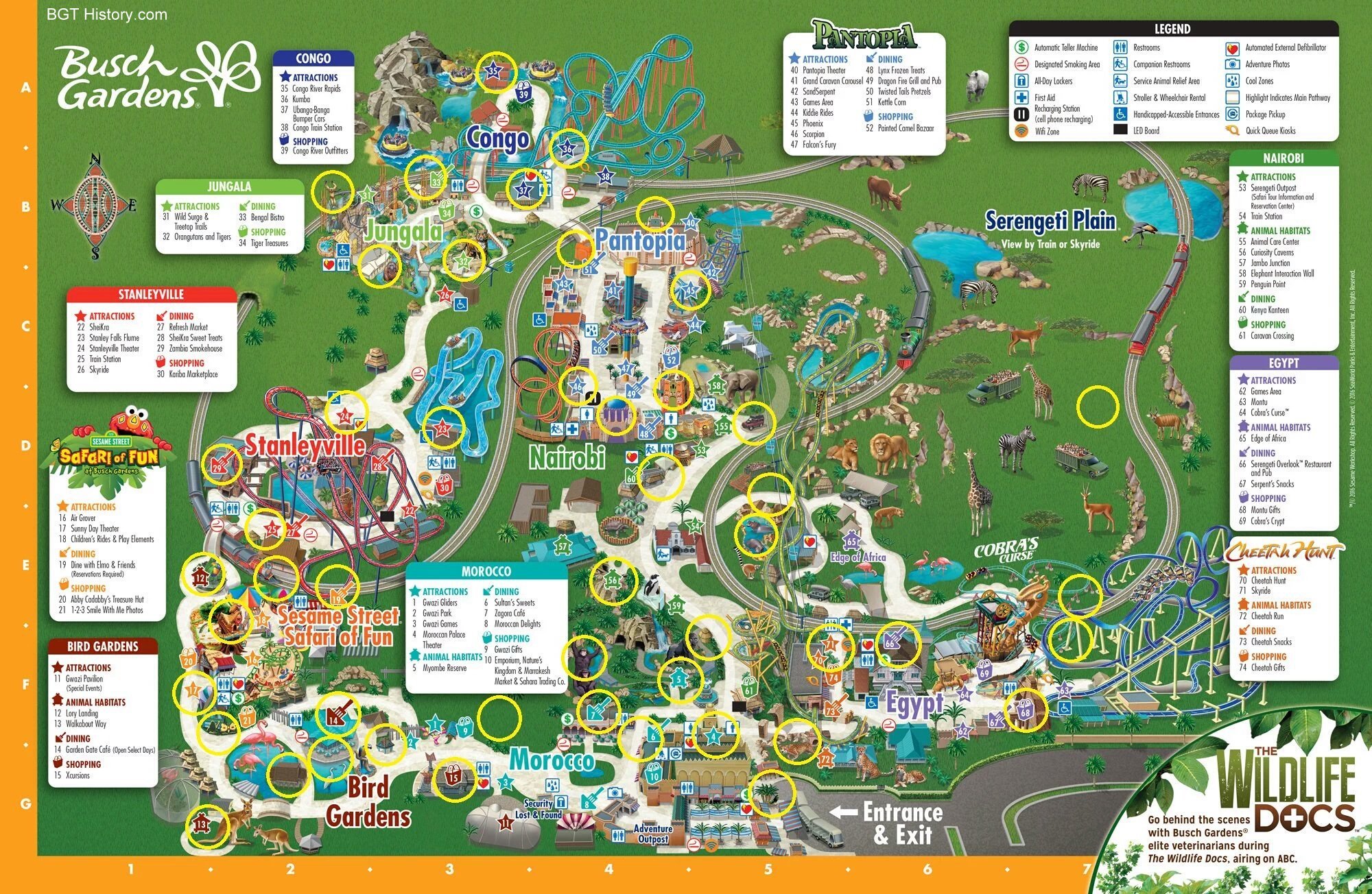
In late July & early August 2016, Busch Gardens joined in the Pokémon GO craze and held an event where a number of “lure” locations were maintained for guests to play throughout the park. A digital map highlighting all of the lure locations was released for the event.
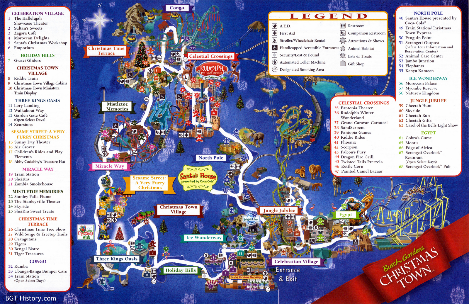
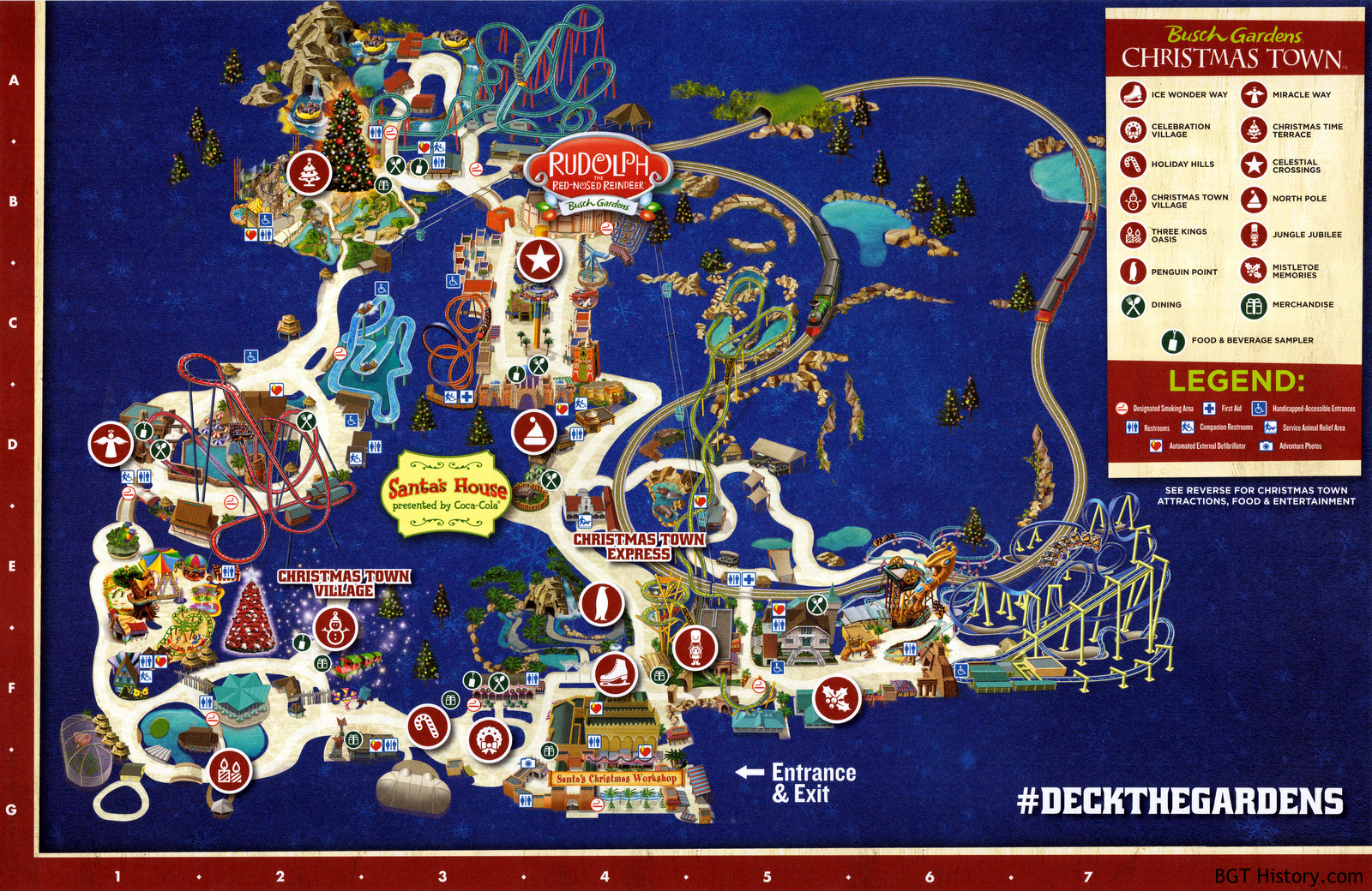
2016 – Christmas Town
2017 – January
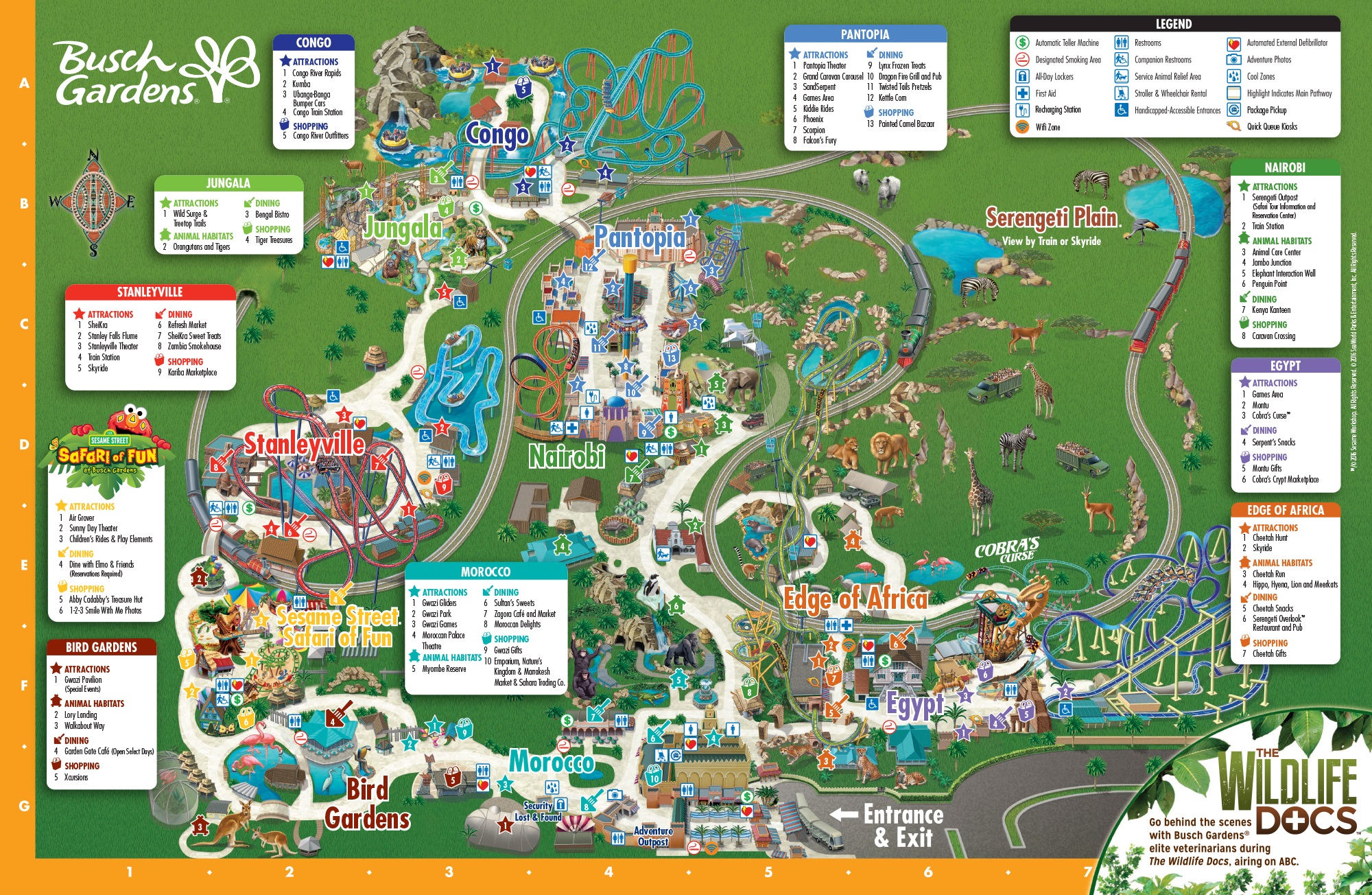
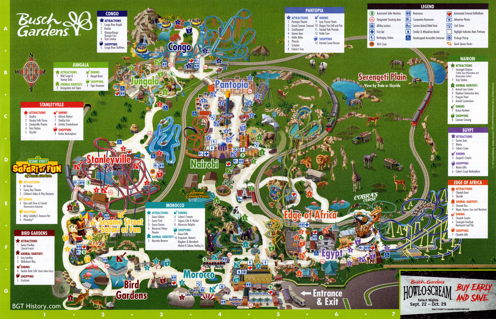
This map, introduced after the first of the year, removes Cheetah Hunt as a designated area and merges it with Edge of Africa. Serengeti Overlook is moved out of Egypt and into the newly enlarged Edge of Africa, which also now includes Cheetah Hunt and Cheetah Run.
2017 – March
This version of the map used during the Food & Wine Festival shows Jambo Junction and Curiosity Caverns completely removed. It also features some minor design changes – the legend and area boxes now have sharp corners instead of rounded edges, and the seasonal advertisement in the lower right corner is now rectangular in shape instead of a semi-circle.
2017 – May
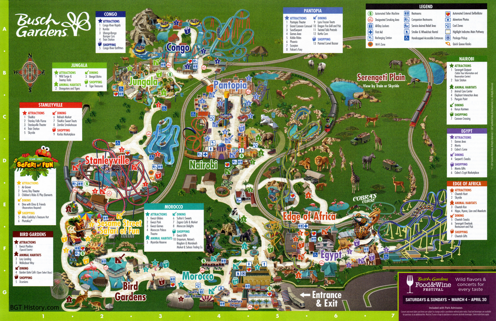
This version of the map includes the new Animal Connections logo over the former Jambo Junction area, and its listing under Nairobi as an official attraction once again. See the back of this map by clicking here.
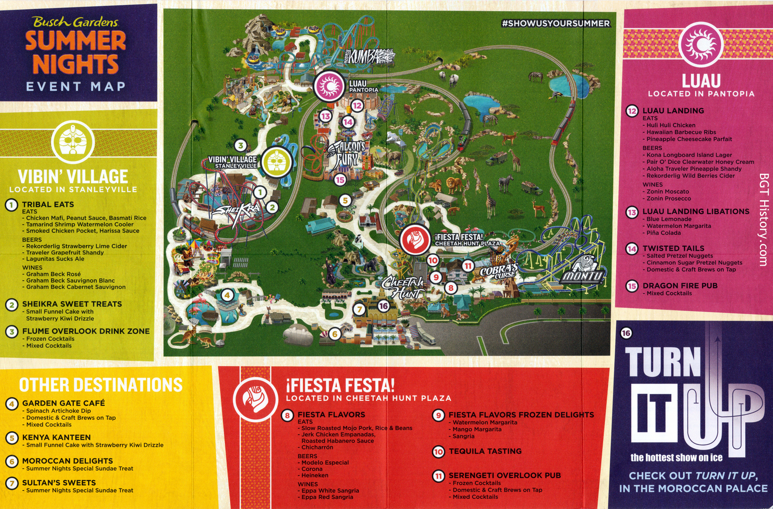
2017 – Summer Nights
As part of the Summer Nights 2017 printed guide, a map showing the various event locations and special menus was available.
2017 – September
Debuting at the beginning of the month, this version of the map only has a couple of small changes. The Sesame Street Safari of Fun logo above the location listing box has changed, with Elmo being removed. Under the Stanleyville listings, SheiKra Sweet Treats is changed to SheiKra Eats.
2017 – Christmas Town
See the back of this map by clicking here.
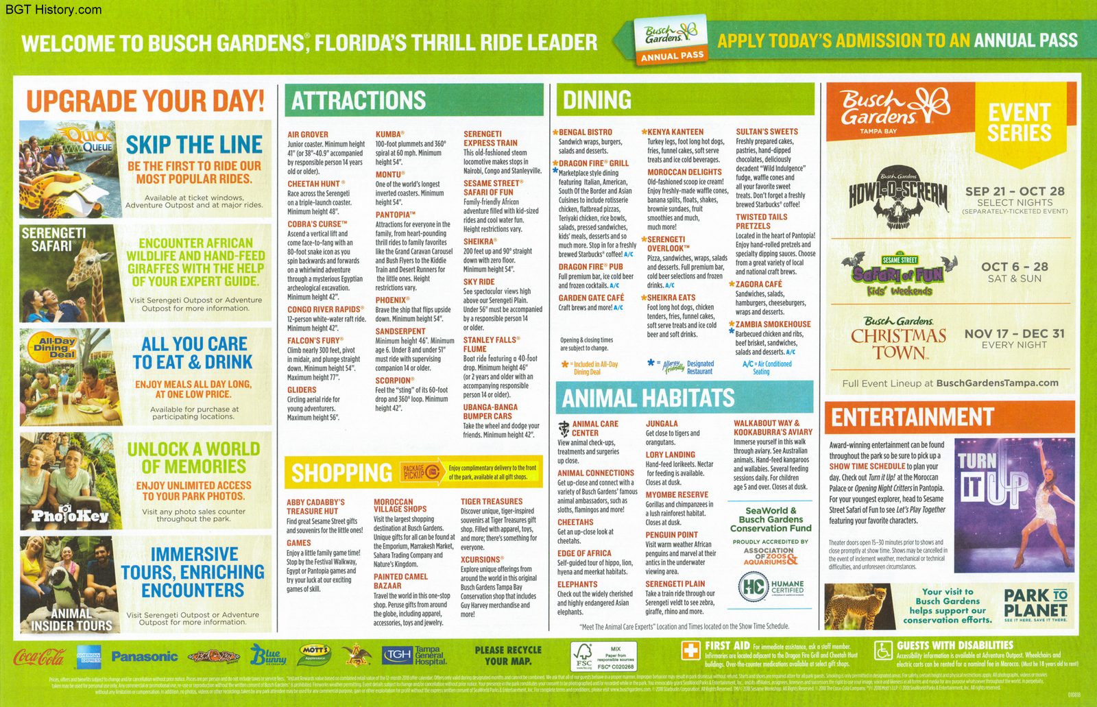
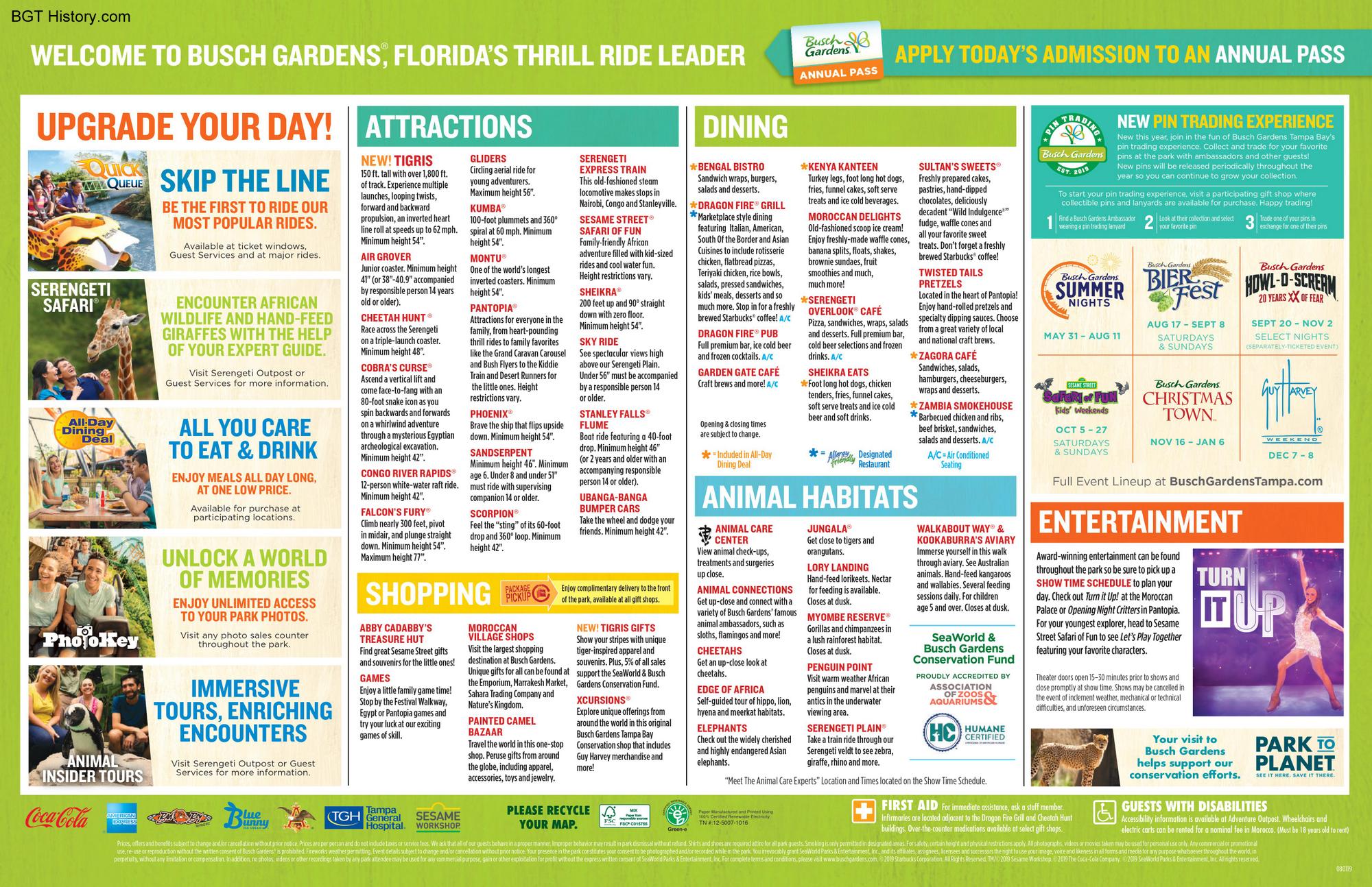
2018 – October
In late October 2018, the map underwent another redesign. Most of the major attractions received names over their location on the map, and instead of listings being broken up by area, they were broken down by type and placed on the right side. In addition to the design changes on the front of the map, the back of the map also received a major change. The printed park hours and showtime guide were removed entirely, instead began being printed on a separate sheet of paper available on the map stands at the main entrance. See the back of this map by clicking here.
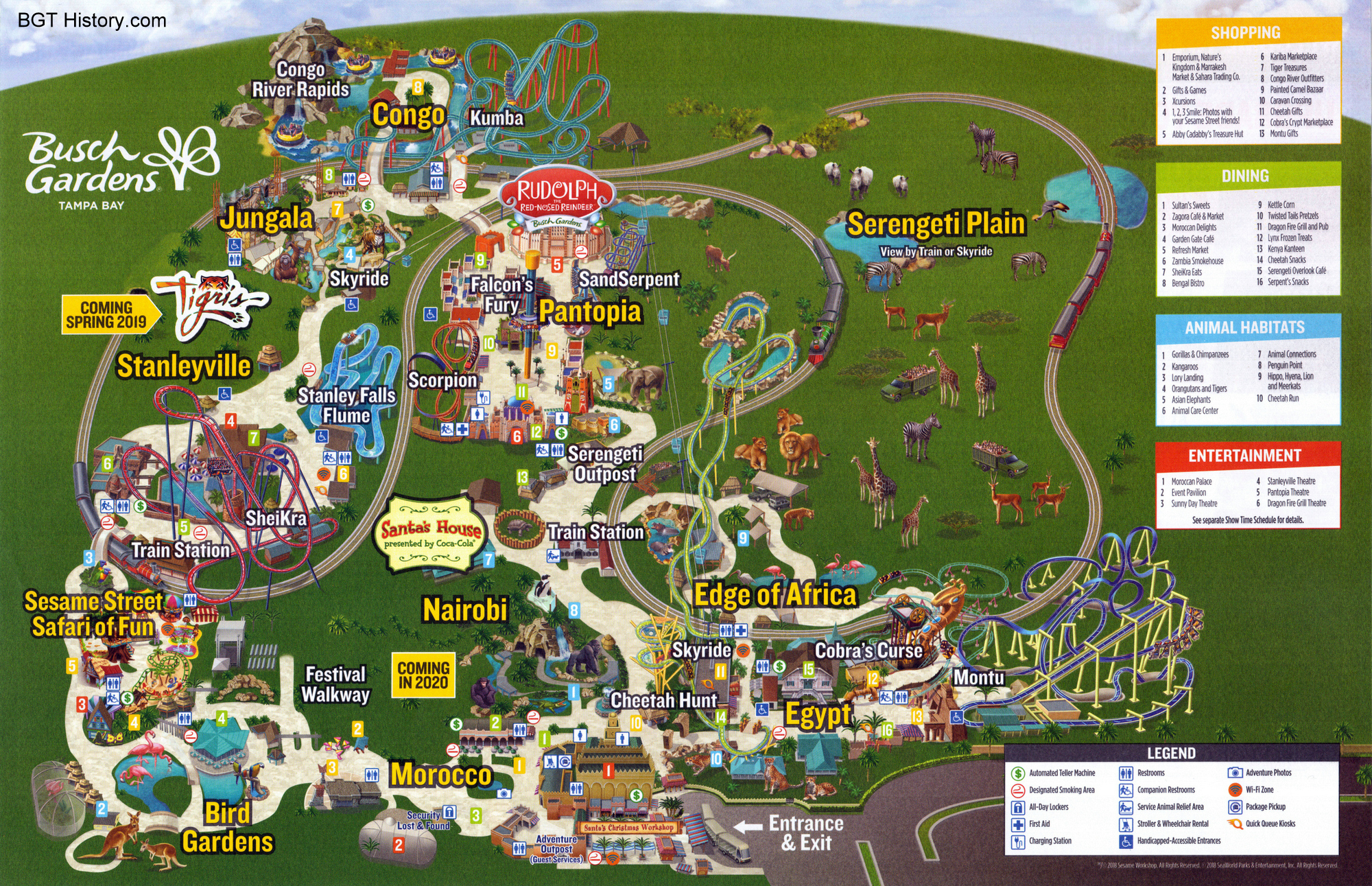
2018 – November
A minor change was made to the map to overlay the Santa’s House and Rudolph & Friends logos for Christmas Town 2018. These small changes along with in-park signage were used for Christmas Town instead of a specially printed park map as had been the case in previous years. See the back of this map by clicking here.
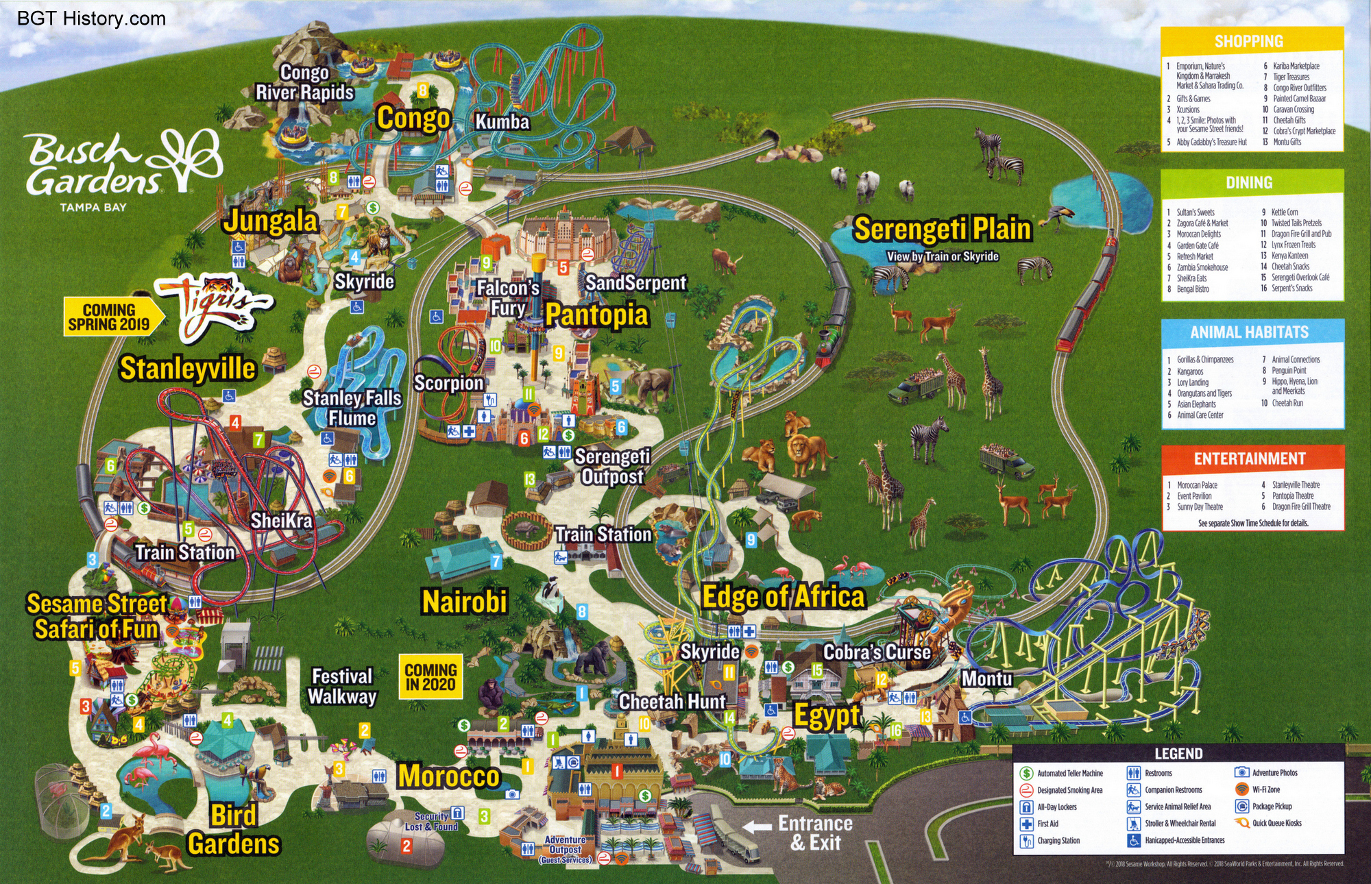
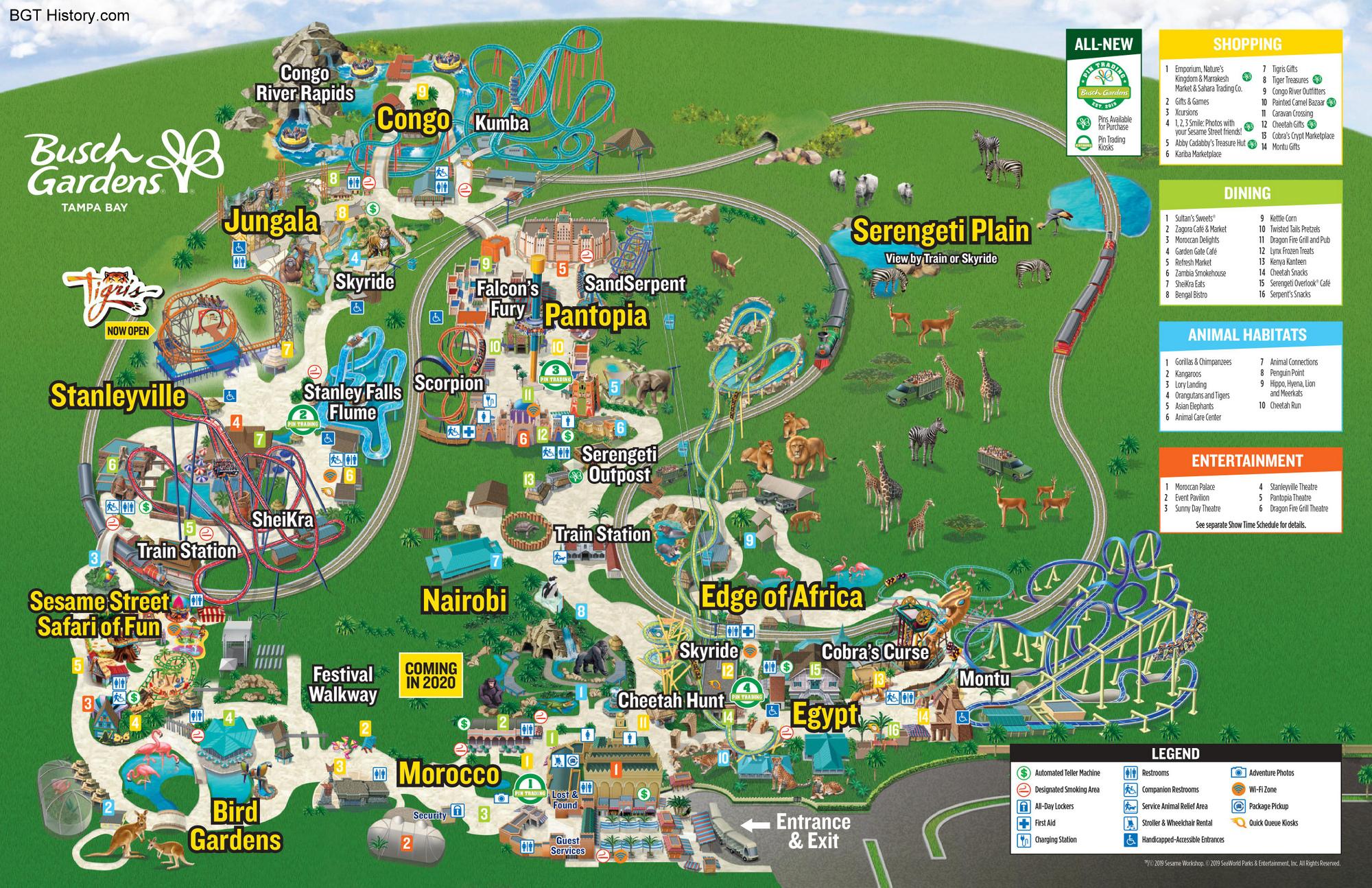
2019 – Summer
This map version includes the addition of Tigris with a ‘Now Open’ banner, plus a box featuring the new Pin Trading information, which debuted earlier in the year. See the back of this may by clicking here.
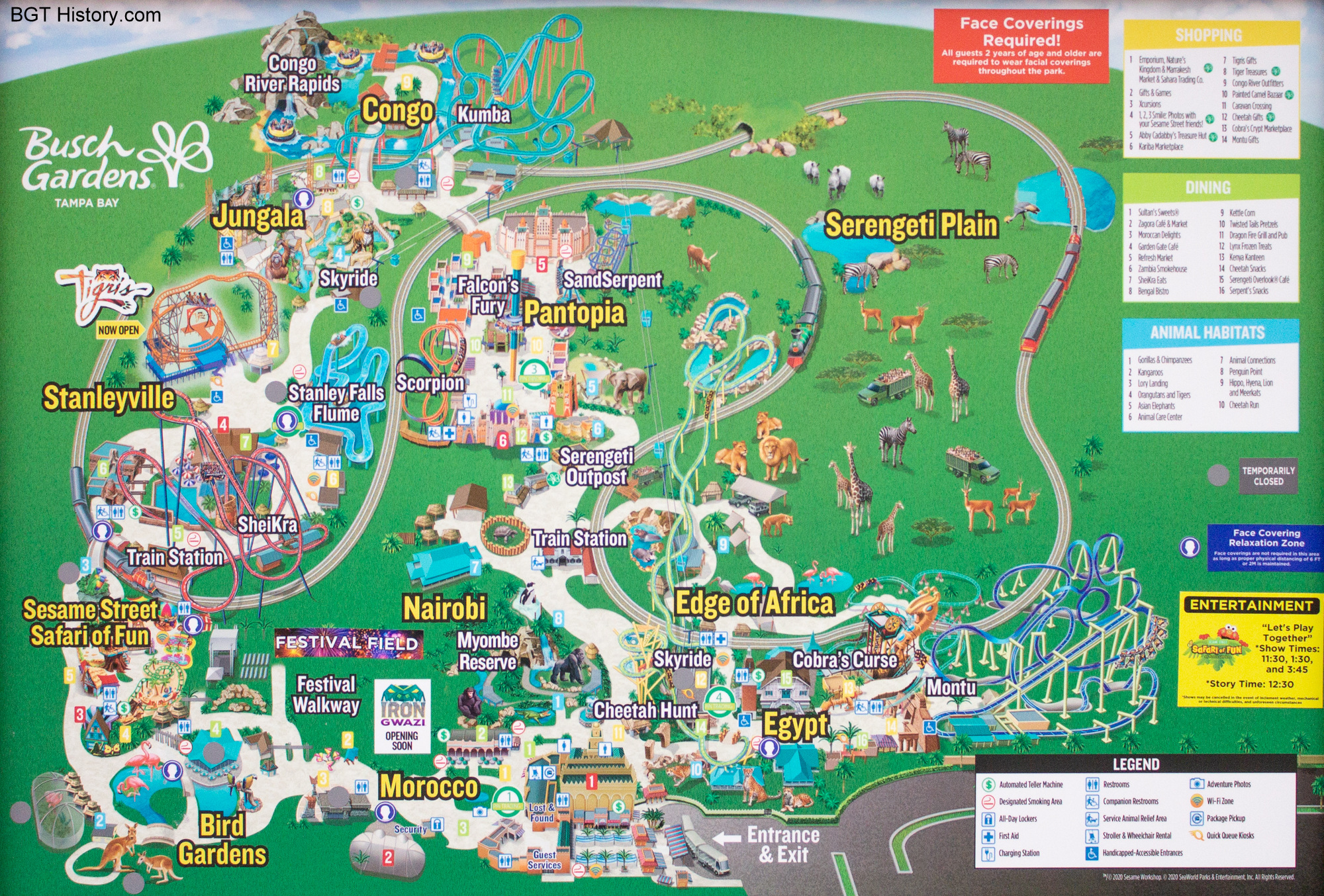
2020 – July
Upon reopening from the nearly three-month closure due to COVID-19 concerns, paper map distribution was suspended. Additional map boards were installed in the entrance area and around the park with signage encouraging guests to take a picture of it to have a digital version on their device to carry with them. This is a photo of one of those map boards, which marks the location of some of the face-covering relaxations zones and attractions that were temporarily closed at that point. It also lists the only scheduled entertainment available in Sesame Street Safari of Fun.
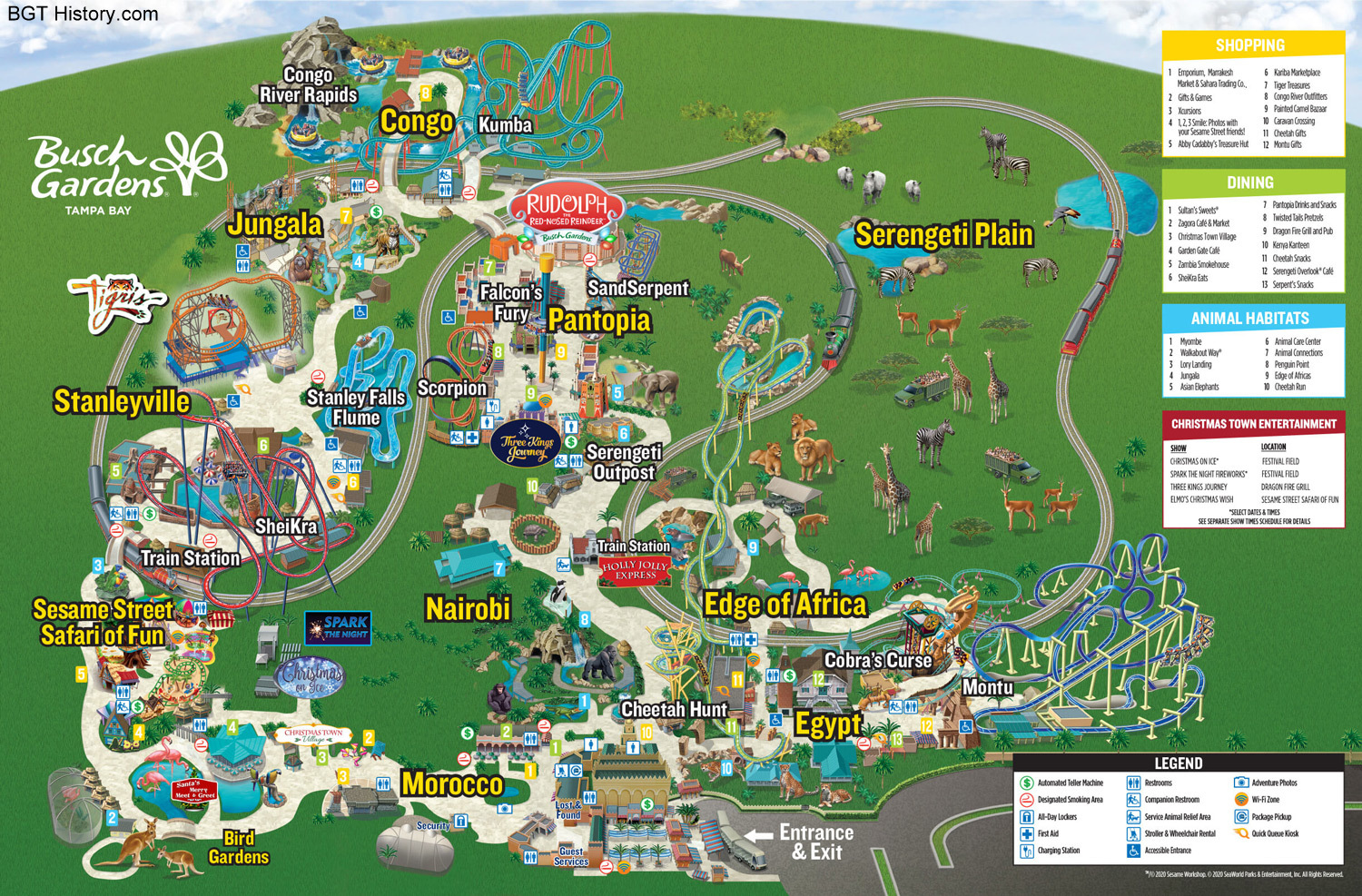
2020 – Christmas Town
The park map received an overlay for the Christmas Town event denoting where the special shows, meet & greets, and villages were located. As was the case since the park reopened earlier in the year, it was only available as a digital download or on map boards in the park.
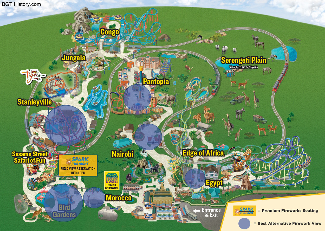
2020 – New Year’s Eve
A special digital version of the park map for December 31, 2020, was released online as part of the New Year’s Eve event information. The map denotes the main location for the fireworks that evening (which required an additional paid reservation), plus other viewing locations around the park available at no extra charge.
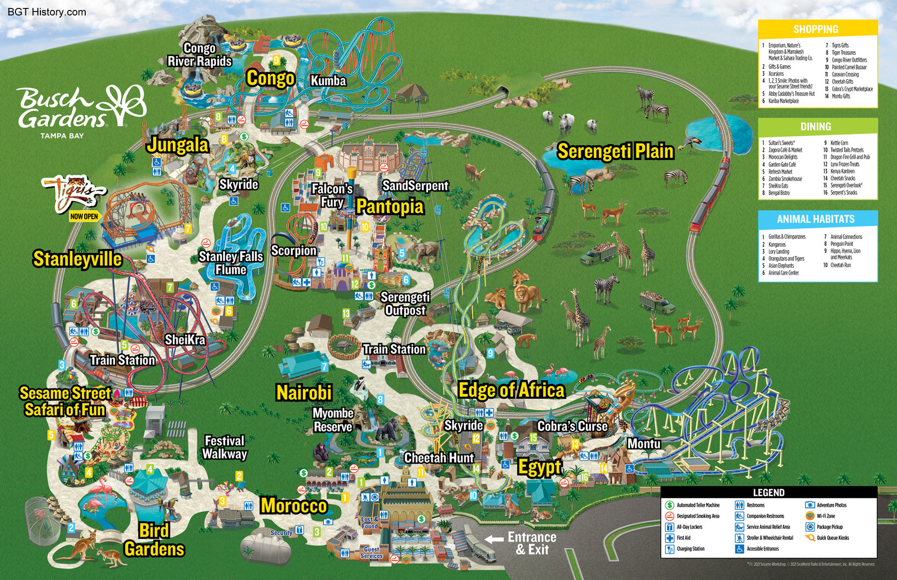
2021
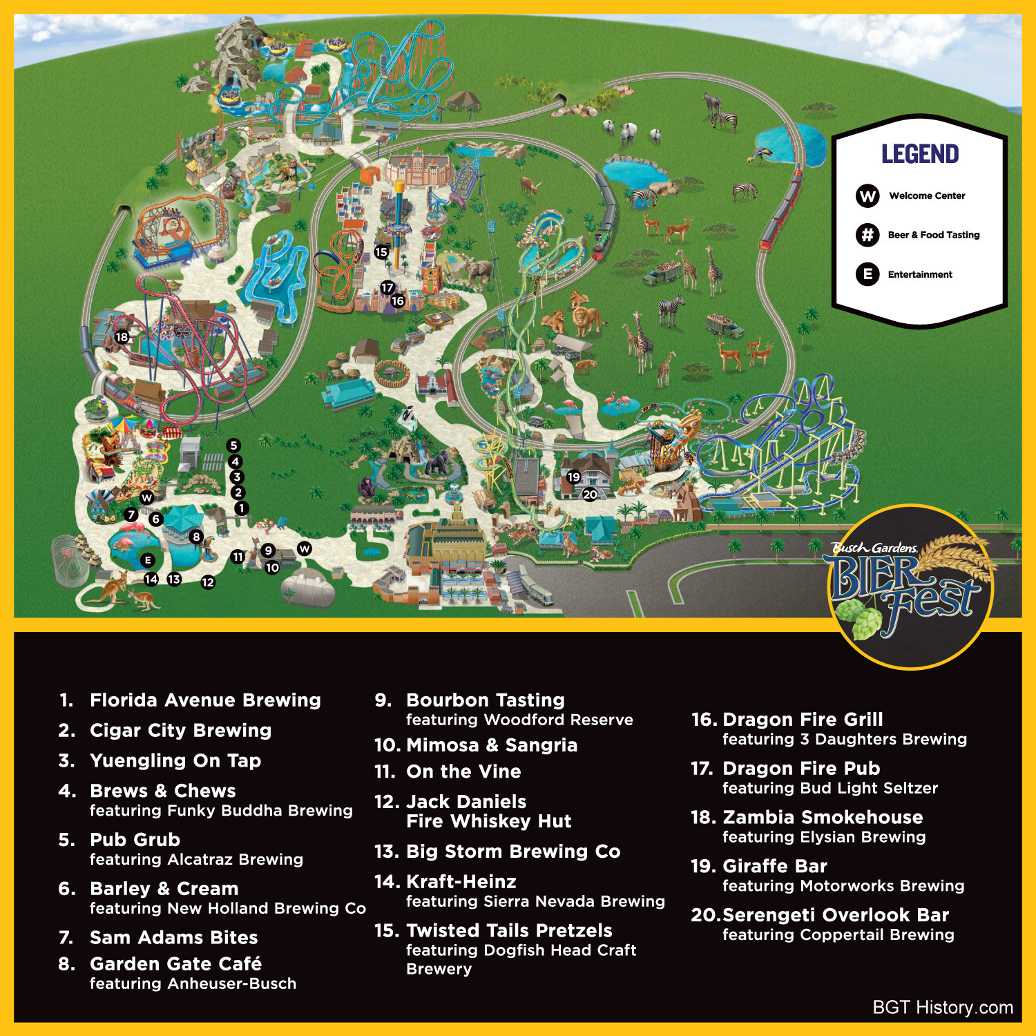
2021 – Bier Fest
The park released a digital map for Bier Fest 2021 with all of the event locations.
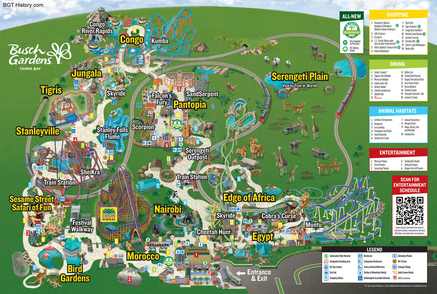
2022 – March
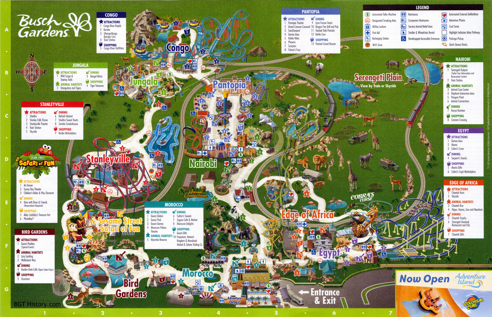
This map features the addition of Iron Gwazi.
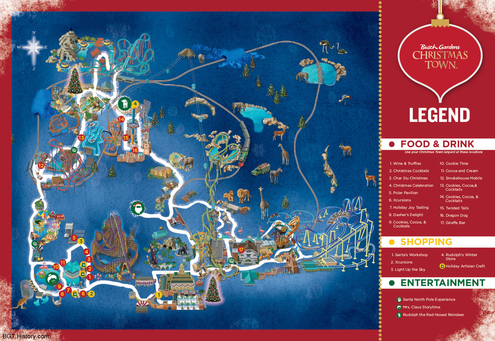
2022 – Christmas Town
A digital map showing the culinary, shopping, and entertainment locations for Christmas Town 2022 was posted on the park’s website in early November.
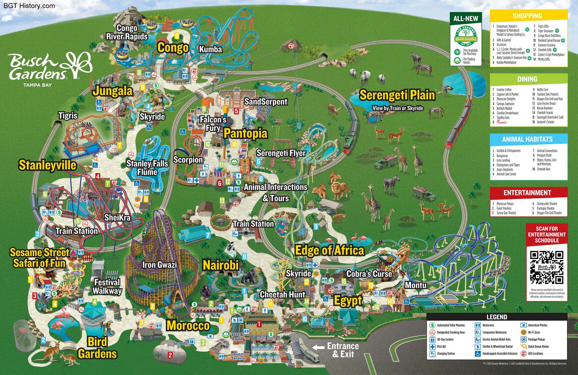
2023 – March
This update features the addition of Serengeti Flyer, which officially opened on February 27, 2023. Also part of the update was the change of Tigris to smaller, white attraction text matching others, the addition of Iron Gwazi as text instead of its logo, and the change of Serengeti Outpost to a more descriptive Animal Interactions & Tours.
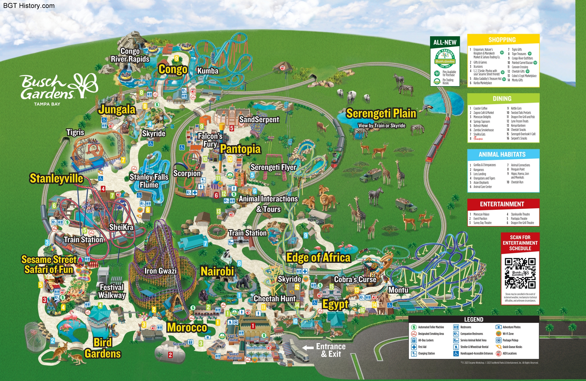
2023 – Spring
Shortly after the update where Serengeti Flyer was added, Phoenix was removed.
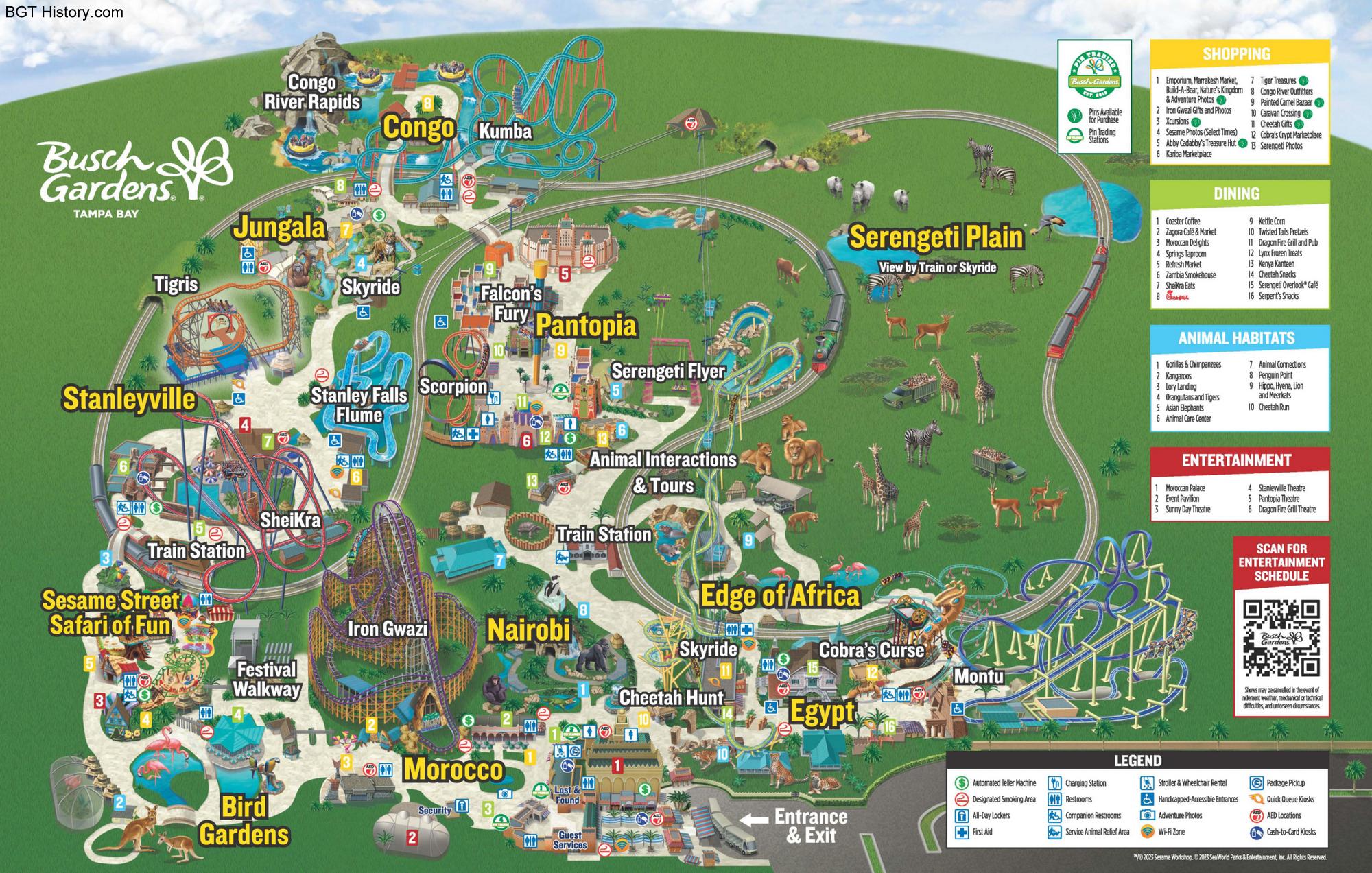
2023 – September
This update removed SandSerpent and Bush Flyers in Pantopia.
Check back as more park maps from Busch Gardens Tampa through the years are added!